Datasets:

Tasks:
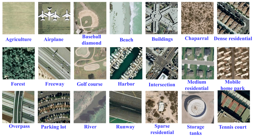
Image Classification
Formats:
parquet
Languages:
English
Size:
1K - 10K
ArXiv:
Tags:
remote-sensing
earth-observation
geospatial
satellite-imagery
land-cover-classification
USGS National Map
License:

- SHA256:
- 3ce2f5f71064447ffc708986841bd20cda29fc389c8de52c48a1411e93680031
- Pointer size:
- 131 Bytes
- Size of remote file:
- 224 kB
- Xet hash:
- 20cc30e92f7d852668d6e44b8087e75b30da9941d335a4c57dec0446061d6e0a
·
·
Xet efficiently stores Large Files inside Git, intelligently splitting files into unique chunks and accelerating uploads and downloads. More info.